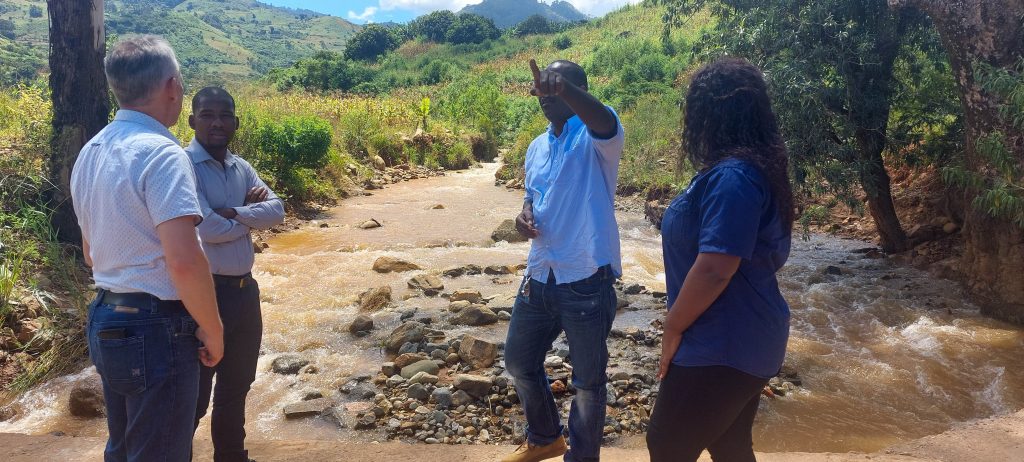
The Licungo river basin in Zambézia Province is a region of concern due to its high flood risk. To address this issue, the Blue Deal programme — a long-term partnership between the Dutch and Mozambican water authorities — organised a meeting with stakeholders in the village of Maganja da Costa in October. This meeting aimed to reduce the region's vulnerability to flooding by aligning technical expertise with local requirements and encouraging participatory land use planning.
Shared responsibility as key to combatting flood risks
The meeting in Maganja da Costa was an important step forward in discussing water and land use management in the region. Led by the General Director of ARA-Norte and the District Administrator of Maganja da Costa, the primary goal of the meeting was to sensitize the four key actors - central and local government authorities, private sector users, civil society, and local communities - about their shared responsibility in this matter.
During the meeting, Jan Den Besten, a representative of the Dutch Water Authorities ( DWA), shared the Netherlands' experience in managing land use and flood risks. Despite the differences in climate, geomorphology and other factors between these two countries, this insight will allow ARA Norte and its key stakeholders to develop an effective strategy for planning and coordinating activities in this flood-prone area.
This occasion equally presented an opportunity to start shifting from a reactive disaster response to a proactive approach based on current and future scenarios.

Incorporating data into decision-making
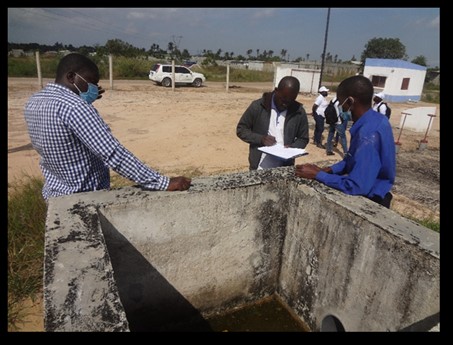
A key moment from the Maganja da Costa meeting was the presentation of new flood risk maps for the Licungo river basin. These critical tools are the direct result of technical capacity building within the Blue Deal programme in Mozambique.
The maps were developed following a specialised training course that ARA-Norte technicians received from their ARA-Centro,IP. This knowledge transfer enabled ARA-Norte professionals to start using advanced platforms to model flood risks more precisely.
These maps are essential instruments for land use planning, as they provide data that, when combined with land use plans, will allow stakeholders to identify “no-build” zones and safe areas for agricultural activities in the Licungo river basin.
The development of these technical capacities directly supports the implementation of Mozambique’s land law, ensuring that land use and benefit rights (DUATs) are granted in accordance with hydrological conditions and preventing the establishment of settlements in areas at high risk of flooding.

Reactivation of the Nante Dike Committee
During the same meeting at Maganja da Costa, the proposal to reactivate the Management Committee for the Nante Dike was also discussed. This infrastructure is vital for protecting the local communities and plantations in Nante Village from the floodwaters of the Licungo river. However, maintaining it requires social mobilisation.
Based on a participatory management model, the new committee structure has been designed to ensure representation from each of the four distinct stakeholder groups. This ensures that the maintenance of the dike is seen as a collective responsibility, not just a government burden.
By engaging the private sector and residents, the committee aims to ensure regular monitoring of the dike's structural integrity and to coordinate rapid mobilisation during the rainy season, ensuring that the flood defences are maintained by a vigilant and organized community.
***
Through the combination of flood risks mapping and social endorsement from local stakeholder committees, ARA-Norte has been working to establish a robust flood risk reduction system. The Blue Deal will continue to work closely with ARA-Norte and the other ARAs on these initiatives.